Wednesday, September 15, 2010

This COULD happen...

In keeping with the notion that you can never have too many laws and that anything that isn't banned ought to be mandated and regulated to death, the state of California has decided to make the biker "wave" mandatory.

As of January 1, 2011, any time two or more bikers pass each other, they will be required to wave at each other. Moreover, the occasion of the wave will do double duty by promoting the important safety message that riders should wear full gear at all times.

This then is the Official state of California Biker Wave:

Saturday, August 21, 2010

2010 Canadian parks Tour Conclusions

My tour through the Canadian parks was a wonderful experience. There was some wear and tear involved. A camera that ALMOST passed the 65 mph drop test, a waist buckle on my backpack melted on the Triumph's exhaust pipes. This righteous callous on my throttle hand after 5 days:


If I was doing this trip over again, I would have either added 2-3 days to it so I could do some real hiking or paddling or aimed for less road miles, with the same objective. Riding through was fantastic but I desperately wanted to get off and wander on foot a bit and the schedule didn't allow for it.

As with previous trips, some people I met along the way were highlights of the trip. For some reason, people seemed to want to say Hello and yack a bit with a middle aged, solo biker, which only added to the trip. It was fantastic meeting the trip of New Zealand Harley riders at the Athabasca Glacier and I hope to visit their home roads, some day.

I can't wait to return to the Canadian Rockies because I know I only barely scratched the surface with this trip...

Resources used in planning the trip:
The Canada Cool web site - @CanadaCool on twitter

Books:
Handbook of the Canadian Rockies by Ben Gadd - samples, my review
This is THE book to have for a trip to the Canadian Rockies, if you can have only one

The Moon Books guide to Western Canada - Andrew Hempstead - my review at Amazon
Covers not only the Rockies but all points of interest in British Columbia, Alberta, the northern Territories

The Canadian Rockies Access Guide - John Dodd, Gail Helgason - I need to review this, it's an excellent guide to trails and outdoor resources

2010 Canadian Parks Tour - Day #5 Heading home Part 2

Since leaving Jasper on the previous day, it seemed that my trip home through the Cariboo would carry reminders of my first ride to Lillooet. I often paralleled the Fraser River or its tributary the Thompson. As with the ride to Lillooet, I saw a black bear.

And the town where I spent my last night in BC was measured in relation to Lillooet. Lillooet was the start of the old Cariboo Trail and there is a whole string of town named for their distance from it. So 100 Mile House is named for its distance from Lillooet along that route. Shots outside the motel where I stayed.


And the Visitors Centre in 100 Mile House is home to the world's largest cross country skis.


A neat inukshuk carved from wood.


Continuing on towards Cache Creek


And in Cache Creek


Continuing South, this river looks kind of sedate, so could be the Bonaparte, North of Lytton


Now, THIS looks like the mighty Fraser!


Boston Bar sign - only including this as it's my last photo taken en route.


From this point, I was pretty much in 'homing' mode. Stopped for a bite in Hope but otherwise headed for home at a good clip. There was an hour's backup at the border on this fine summer day, so that by the time I spoke with the US immigration officer, I had sweated THROUGH my leather jacket. Soon, i was home...and looking forward to more journeys North.

2010 Canadian Parks Tour - Day #4 Heading home Part 1

The journey home from my visit to the Canadian Rockies started when I left Jasper National Park and traveled through Mount Robson Provincial Park. The entrance to Mount Robson Park contained the only mountain goat that I saw on my trip:


Mount Robson is the highest peak in the Canadian Rockies, towering to 3954 metere/12972 feet.


Pressing on through Mount Robson park, I was also reacquainted with an old friend. The Fraser River, which I journeyed alongside on my first ride up to Lilllooet, originates in Mount Robson Park and it would be accompanying me down through much of my journey back to the Vancouver area.

The gorgeous mountain vistas continued along the way.


I rode through a lot of small towns as I continued on towards Wells Gray Provincial Park but did not make many stops, as I was going for a bit over 300 miles on the fourth day.
As with the mountain goat at Mount Robson, the only moose that I saw on my trip was not very lively.


Past Clearwater, I traveled on to Little Fort. There, I abandoned the Coquihalla (which I had taken South from TĂȘte Jaune Cache) and headed West on 24.

Amusingly, I had been prepared to see bears anywhere along my journey, especially in Banff and Jasper. But I did not see a bear until just after I had passed McDonald Pass on 24. As I rode along, a black bear suddenly ran across the road about 100 yards ahead. As I slowed to have more reaction time, he also slowed and then resumed running across the road.

Why did the bear cross the road? I don't know, maybe he was following a chicken? :)

One reason I was hurrying a bit was that the skies had been threatening rain since Clearwater and eventually they followed through on their threats. A light rain started, accompanied by some thunder. Having learned last year that it's smart not to ride in thunderstorms and heavy rain, I pulled into a small general store at Bridge Lake to wait out the thunderstorm and see if it would stop raining. The owners were very nice in letting me wait on their front porch.


After I thanked them and rode on, the rain did start up again but fortunately there was no more thunder/lightning. I reached the town of 100 Mile House and stopped for the night.

Wednesday, August 18, 2010

2010 Canadian Parks Tour - Day #4 Back through Jasper

As I mentioned, I stayed overnight in Hinton, AB. The Howard Johnson folks kindly offered to let me park my bike in a No Parking zone, right outside the window...they offer that privilege to motorcyclists so their bikes will be in sight over night. A nice considerations:


Another result of glacial activity: a local beer brand named after huge glacial erratic (deposited boulder) in Okotoks.


An large grizzly statue outside of a nearby grocery store:


heading back into Jasper National Park


A historical marker for the former Jasper House


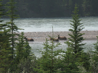
And some elk:


Shortly after riding into the park, I cut over towards Maligne Lake. That was not my goal but the next stop, Medicine Lake, lies on the way to Maligne Lake. Stopped to photograph this bear warning...and that digital camera has not worked since.


Luckily, my cell phone has a passable camera built in and I was able to capture these photos of Medicine Lake, my last objective in the National Parks. Medicine Lake is an oddity, as it empties out annually through an underground cave system known as 'karst'. Thus, it fills with glacial melt water during the warm months but empties out as dropping temperatures rob it of its water source. First Nations peoples originally called it Magic Lake.


Leaving Medicine Lake, I noted an impressive bull elk eating by the side of the road, with a small traffic jam developing and numerous people without sufficient instinct for self preservation gathering around it. I hope it was not a Darwin Award in the making!

2010 Canadian Parks Tour - Day #3 - On to Jasper National Park

And the road lead on towards Jasper...


This wasn't a place I'd planned to explore but I'm glad I did so spontaneously. Sunwapta Falls...it's so utterly beautiful that I just stared at it in amazement for minutes.


Sad face - as I rode onwards and stopped repeatedly for pictures, I inadvertently left the camera pocket on my tank bag unzipped and my camera bailed out at about 65 mph. My face is saying, "Do You Still Work?!?!?!"


Mount Edith Cavell, named after a British heroine from World War I.


At last, Jasper National Park's Info Centre:


I was staying overnight outside of Jasper in Hinton, Alberta. Stopped along the way to take photos of the sand dunes that have collected from glacial silt, along Lake Jasper: